Jon and E have taken me on bike rides around Minneapolis for the last two Sundays. I love it! But since I didn't bring my camera, I used Flickr to illustrate this post. The first Sunday, we rode around the west side of Lake Calhoun,
(picture by danamongo2007)
then took a hairpin turn to ride under the Lake Street Bridge that goes over the canal between Calhoun and Lake of the Isles. If you keep going right, then you end up at the crossroads of the Midtown Greenway, the rails-to-trails bike trail that goes through the center of the metropolitan area all the way to the Mississippi.
then took a hairpin turn to ride under the Lake Street Bridge that goes over the canal between Calhoun and Lake of the Isles. If you keep going right, then you end up at the crossroads of the Midtown Greenway, the rails-to-trails bike trail that goes through the center of the metropolitan area all the way to the Mississippi.
(photo by Micah Taylor)
So we rode all the way to the Mississippi!
We ate at MooseandSadies (we bike to eat, my new motto), took a look at the new 35W bridge, poked around at Mill Ruins Park, rode over the Stone Arch Bridge, and then got on the Light Rail with our bikes and took it to Minnehaha Park.
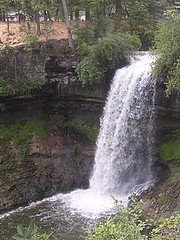
(photo by s_sgore)
We had a look at the Falls - I have vague memories of being here with the entire family, and Jeni walking under the falls. I'm not sure they'd be too happy if you did that today....
We had a look at the Falls - I have vague memories of being here with the entire family, and Jeni walking under the falls. I'm not sure they'd be too happy if you did that today....
This week we rode from Lake Harriet to Minnehaha and then farther (I can't remember the trail name), over the Mendota Bridge (that was cool, but the cars were NOISY) into Saint Paul. We went over another cool bridge, what was it's name? and anyway, ended up at Cafe Latte for lunch (felt like brunch since I had a little breakfast.) We wanted to go home the easiest way since one of our party had a sore leg. I just followed the group and we ended up on the Greenway again. This last ride was 34 miles, and I had a happy butt when I got off my bike.
I promise to bring my camera next time!


Yeah, you better bring it.
ReplyDeleteLove,
N.
The trail you found on the far side of the Mendota bridge is the Big Rivers Regional trail (www.co.dakota.mn.us/LeisureRecreation/CountyParks/Locations/BigRivers/default.htm).
ReplyDeleteSummer map www.co.dakota.mn.us/NR/rdonlyres/5EFC16FB-346A-4BDA-900C-D1AEB0339BD9/8577/2008BigRiversSummerTrailMap1.pdf
I don't think that the route through Fort Snelling and the Mendota bridge has a name.
I recently led a group on a combination of the Minnehaha, Lake Harriet, Lake Calhoun, Greenway, Kenilworth, Greenway, and Big Rivers trails with a few streets in Minneapolis and Bloomington tossed in and using the entire light rail. http://maps.google.com/maps/ms?f=q&hl=en&om=1&ie=UTF8&msa=0&msid=101801227834931615797.000453f983c916e7e84bc&z=12
None of the streets used are difficult or hazardous. The route can be divided into 14 and 9 mile segments based on which segment of the light rail you use.
Big Rivers Regional Trail - thanks for the name. These trails are awesome.
ReplyDelete